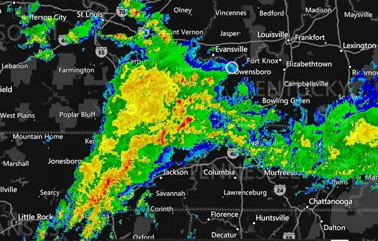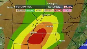
Jeff Lyons and the team at WFIE say windy and warm conditions this will spawn strong to severe thunderstorms and possibly tornadoes across the Tri-State. The Storm Prediction Center has the southern half of the Tri-State in a Slight Risk for severe weather Saturday.
Damaging winds will be a concern, especially with waterlogged soil. Trees will be more easily uprooted with winds over 50 mph. The tornado risk gets higher the farther south you go, especially into Tennessee. Still a few tornadoes may spin up along the warm front as it moves in during the early afternoon. The models bring a line of storms in from the southwest around 2pm. Western Kentucky will see the first storms as the warm front lifts through Tennessee.
The National Weather Service is also keeping an eye on things for portions of south central Indiana and north central Kentucky. Strong to severe thunderstorms are possible this evening as a strong cold front moves through the area. The strongest cells will be capable of producing locally damaging wind gusts and brief spin-up tornadoes, mainly west of I-65.
Strong and gusty west winds are expected Sunday behind a strong cold front. Gusts exceeding 40 mph are likely.
Area rivers will remain high from recent rainfall. See our webpage for the most recent updates to river flood advisories and flood warnings.
Pockets of heavy rain are likely today, with an additional 1 inch or more expected. Localized flooding is possible in low-lying areas and near small streams.
Stay up-to-date with WFIE!


