The National Weather Service has issued a Winter Weather Advisory that will be in effect from noon Saturday to midnight Saturday night.
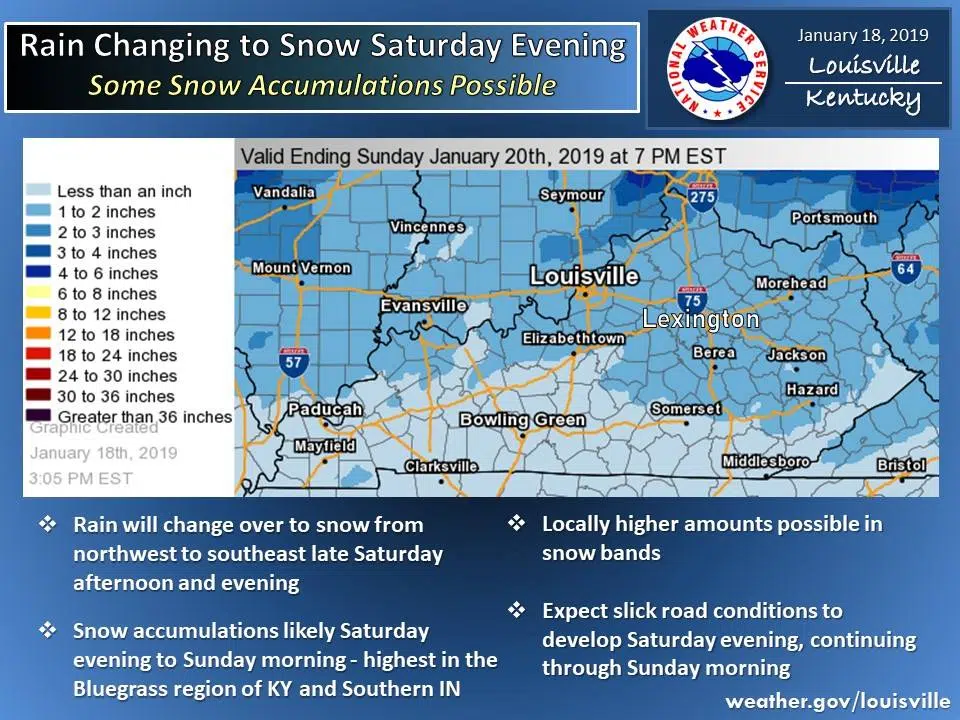
Rain will change to snow Saturday afternoon into Saturday night. Accumulations of 1 to 2 inches, with locally higher amounts upwards to 3 inches possible, are expected mainly north of the Ohio river, with generally less than 1-inch amounts across the south.
This potent weather system will bring an Arctic blast of air with a myriad of impacts. Strong and gusty winds will impact travel and also bring in cold air with single digit to lower teens wind chills. Plunging sub freezing temperatures will create flash freeze and black ice potential for any residual ground or roadway moisture. In addition, winds may produce reduced visibility where blowing snow is moderate to heavy.
A winter weather advisory means that periods of snow, sleet, or freezing rain will cause travel difficulties. Be prepared for slippery roads and limited visibilities…and use caution while driving.
A winter weather advisory for blowing snow means that visibilities will be limited due to strong winds blowing snow around. Use caution when traveling…especially in open areas.
Weather outlook for the weekend looks like this: